 vesseltracker.com
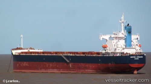
Vessel Dimitris A IMO: 9398656, MMSI: 210066000 Bulk Carrier
UTC, -36.88833, 28.41667, course: -1, speed: 10
UTC, -36.80167, 28.77833, course: -1, speed: 10
2026-02-26 01:35:44 UTC, -36.70356, 29.13744, course: 73, speed: 10.9
Live AIS position:
UTC. 219 nm SE of Kenton-on-Sea),
updated 2026-02-26 01:35:44 UTC.
Find the position of the vessel Dimitris A on the map. The latter are known coordinates and path.
marine traffic ship tracker show on live map
The current position of vessel Dimitris A is -36.70356 lat / 29.13744 lng. Updated: 2026-02-26 01:35:44 UTCCurrently sailing under the flag of Cyprus
Dimitris A built in 2008 year
Deadweight:
82518 tDetails:
Last coordinates of the vessel:
UTC, -37.13201, 27.47135, course: 73, speed: 11.8UTC, -36.88833, 28.41667, course: -1, speed: 10
UTC, -36.80167, 28.77833, course: -1, speed: 10
2026-02-26 01:35:44 UTC, -36.70356, 29.13744, course: 73, speed: 10.9