 vesseltracker.com
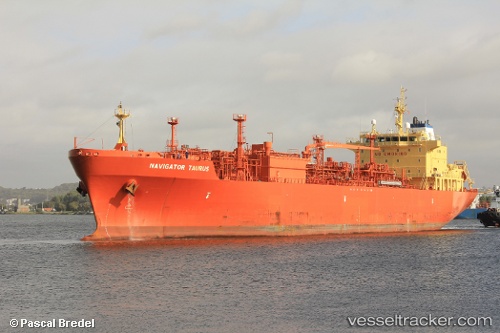
Vessel Navigator Taurus IMO: 9404807, MMSI: 636014078 Lpg Tanker
UTC, 35.97336, -0.01525, course: 356, speed: 2.9
UTC, 35.93870, -0.17257, course: 340, speed: 2.6
2026-02-15 19:49:36 UTC, 35.94712, -0.08804, course: 255, speed: 1.6
Live AIS position:
UTC. Near Mostaganem),
updated 2026-02-15 19:49:36 UTC.
Find the position of the vessel Navigator Taurus on the map. The latter are known coordinates and path.
marine traffic ship tracker show on live map
The current position of vessel Navigator Taurus is 35.94712 lat / -0.08804 lng. Updated: 2026-02-15 19:49:36 UTCCurrently sailing under the flag of Liberia
Navigator Taurus built in 2009 year
Deadweight:
23316 tDetails:
Last coordinates of the vessel:
UTC, 35.98042, -0.09131, course: 356, speed: 3.3UTC, 35.97336, -0.01525, course: 356, speed: 2.9
UTC, 35.93870, -0.17257, course: 340, speed: 2.6
2026-02-15 19:49:36 UTC, 35.94712, -0.08804, course: 255, speed: 1.6