 vesseltracker.com
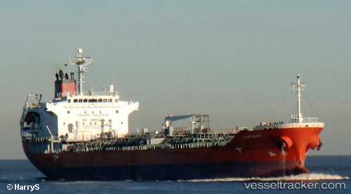
Vessel MALED IMO: 9408798, MMSI: 314908000 Oil/Chemical Tanker
UTC, 16.23541, 70.23748, course: 128, speed: 12.6
UTC, 15.90790, 70.74128, course: 136, speed: 12.7
2026-02-27 22:23:49 UTC, 15.66333, 71.07833, course: -1, speed: 12
Live AIS position:
UTC. 150 nm SW of RATNAGIRI),
updated 2026-02-27 22:23:49 UTC.
Find the position of the vessel MALED on the map. The latter are known coordinates and path.
marine traffic ship tracker show on live map
The current position of vessel MALED is 15.66333 lat / 71.07833 lng. Updated: 2026-02-27 22:23:49 UTCCurrently sailing under the flag of Barbados
Details:
Last coordinates of the vessel:
UTC, 16.42500, 69.96667, course: -1, speed: 12UTC, 16.23541, 70.23748, course: 128, speed: 12.6
UTC, 15.90790, 70.74128, course: 136, speed: 12.7
2026-02-27 22:23:49 UTC, 15.66333, 71.07833, course: -1, speed: 12