 vesseltracker.com
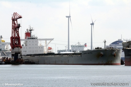
Vessel Cape Celtic IMO: 9409144, MMSI: 354526000 Ore Carrier
UTC, 30.80524, 124.02416, course: 195, speed: 14.7
UTC, 30.51280, 124.02182, course: 165, speed: 15.6
2026-01-18 17:30:23 UTC, 30.40751, 124.04313, course: 186, speed: 15.6
Live AIS position:
UTC. 78 nm E of Lü-hua Shan),
updated 2026-01-18 17:30:23 UTC.
Find the position of the vessel Cape Celtic on the map. The latter are known coordinates and path.
marine traffic ship tracker show on live map
The current position of vessel Cape Celtic is 30.40751 lat / 124.04313 lng. Updated: 2026-01-18 17:30:23 UTCDetails:
Last coordinates of the vessel:
UTC, 31.10592, 124.07636, course: 185, speed: 14UTC, 30.80524, 124.02416, course: 195, speed: 14.7
UTC, 30.51280, 124.02182, course: 165, speed: 15.6
2026-01-18 17:30:23 UTC, 30.40751, 124.04313, course: 186, speed: 15.6