 vesseltracker.com
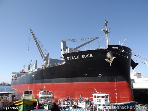
Vessel Belle Rose IMO: 9410600, MMSI: 355783000 Bulk Carrier
UTC, 24.01304, 147.46568, course: 300, speed: 9.4
UTC, 24.17575, 147.11806, course: 301, speed: 10
2026-02-04 02:10:16 UTC, 24.34270, 146.78070, course: 300, speed: 9.6
Live AIS position:
UTC. 298 nm SE of Omura),
updated 2026-02-04 02:10:16 UTC.
Find the position of the vessel Belle Rose on the map. The latter are known coordinates and path.
marine traffic ship tracker show on live map
The current position of vessel Belle Rose is 24.34270 lat / 146.78070 lng. Updated: 2026-02-04 02:10:16 UTCDetails:
Last coordinates of the vessel:
UTC, 23.90989, 147.68156, course: 300, speed: 10UTC, 24.01304, 147.46568, course: 300, speed: 9.4
UTC, 24.17575, 147.11806, course: 301, speed: 10
2026-02-04 02:10:16 UTC, 24.34270, 146.78070, course: 300, speed: 9.6