 vesseltracker.com
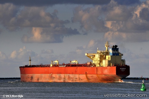
Vessel BRATSK IMO: 9411020, MMSI: 273250630 Crude Oil Tanker
UTC, 56.06501, 3.74928, course: 44, speed: 5.4
UTC, 56.27473, 3.84899, course: 28, speed: 5.5
2026-02-06 09:31:42 UTC, 56.44535, 3.87501, course: 23, speed: 6.3
Live AIS position:
UTC. 26 nm NW of South Arne),
updated 2026-02-06 09:31:42 UTC.
Find the position of the vessel BRATSK on the map. The latter are known coordinates and path.
marine traffic ship tracker show on live map
The current position of vessel BRATSK is 56.44535 lat / 3.87501 lng. Updated: 2026-02-06 09:31:42 UTCCurrently sailing under the flag of Russia
BRATSK built in 2009 year
Deadweight:
156572 tDetails:
Last coordinates of the vessel:
UTC, 55.96622, 3.67919, course: 43, speed: 5.2UTC, 56.06501, 3.74928, course: 44, speed: 5.4
UTC, 56.27473, 3.84899, course: 28, speed: 5.5
2026-02-06 09:31:42 UTC, 56.44535, 3.87501, course: 23, speed: 6.3