 vesseltracker.com
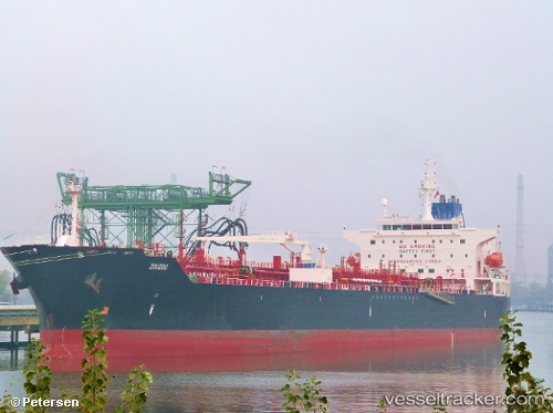
Vessel ST GEORGE IMO: 9412775, MMSI: 636021942 Chemical/Oil Products Tanker
UTC, 59.85570, 26.00673, course: -1, speed: 0.4
UTC, 59.85597, 26.00628, course: -1, speed: 0.4
2026-02-27 13:49:30 UTC, 59.85618, 26.00576, course: -1, speed: 0
Live AIS position:
UTC. 15 nm NE of Viinistu Sadam),
updated 2026-02-27 13:49:30 UTC.
Find the position of the vessel ST GEORGE on the map. The latter are known coordinates and path.
marine traffic ship tracker show on live map
The current position of vessel ST GEORGE is 59.85618 lat / 26.00576 lng. Updated: 2026-02-27 13:49:30 UTCCurrently sailing under the flag of Liberia
ST GEORGE built in 2010 year
Deadweight:
50651 tDetails:
Last coordinates of the vessel:
UTC, 59.85617, 26.00583, course: -1, speed: 0.4UTC, 59.85570, 26.00673, course: -1, speed: 0.4
UTC, 59.85597, 26.00628, course: -1, speed: 0.4
2026-02-27 13:49:30 UTC, 59.85618, 26.00576, course: -1, speed: 0