 vesseltracker.com
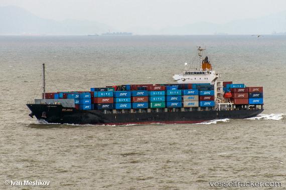
Vessel Belawan IMO: 9412828, MMSI: 477883500 Container Ship
UTC, -0.34125, 106.83908, course: 322, speed: 15.4
UTC, 0.13483, 106.66888, course: 349, speed: 15.3
2026-02-05 14:10:59 UTC, 0.62013, 106.56408, course: 350, speed: 15.3
Live AIS position:
UTC. 118 nm E of KIJANG),
updated 2026-02-05 14:10:59 UTC.
Find the position of the vessel Belawan on the map. The latter are known coordinates and path.
marine traffic ship tracker show on live map
The current position of vessel Belawan is 0.62013 lat / 106.56408 lng. Updated: 2026-02-05 14:10:59 UTCCurrently sailing under the flag of Hong Kong
Belawan built in 2007 year
Deadweight:
21973 tDetails:
Last coordinates of the vessel:
UTC, -0.83725, 107.25445, course: 315, speed: 15UTC, -0.34125, 106.83908, course: 322, speed: 15.4
UTC, 0.13483, 106.66888, course: 349, speed: 15.3
2026-02-05 14:10:59 UTC, 0.62013, 106.56408, course: 350, speed: 15.3