 vesseltracker.com
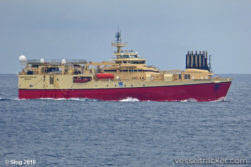
Vessel Tansa IMO: 9413303, MMSI: 431096000 Research Vessel
UTC, 30.34500, 132.28500, course: -1, speed: 4
UTC, 30.56500, 132.30833, course: -1, speed: 4
2026-02-15 09:55:51 UTC, 30.67833, 132.23833, course: -1, speed: 4
Live AIS position:
UTC. 65 nm E of NISHINOOMOTE),
updated 2026-02-15 09:55:51 UTC.
Find the position of the vessel Tansa on the map. The latter are known coordinates and path.
marine traffic ship tracker show on live map
The current position of vessel Tansa is 30.67833 lat / 132.23833 lng. Updated: 2026-02-15 09:55:51 UTCDetails:
Last coordinates of the vessel:
UTC, 30.22091, 132.25792, course: 0, speed: 4.3UTC, 30.34500, 132.28500, course: -1, speed: 4
UTC, 30.56500, 132.30833, course: -1, speed: 4
2026-02-15 09:55:51 UTC, 30.67833, 132.23833, course: -1, speed: 4