 vesseltracker.com
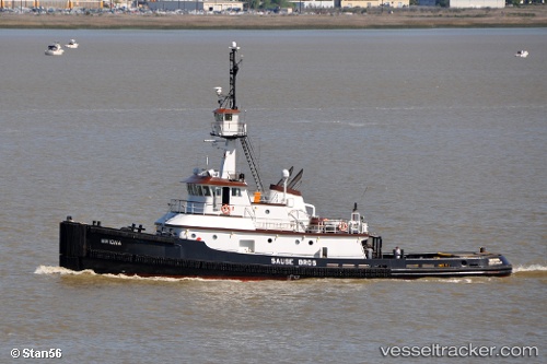
Vessel Mikiona IMO: 9415583, MMSI: 367153070 Tug
UTC, 34.54459, -121.41702, course: 332, speed: 10
UTC, 34.82461, -121.59170, course: 332, speed: 9.3
2026-02-24 03:47:40 UTC, 35.07826, -121.73807, course: 331, speed: 9.9
Live AIS position:
UTC. 47 nm SW of Cayucos),
updated 2026-02-24 03:47:40 UTC.
Find the position of the vessel Mikiona on the map. The latter are known coordinates and path.
marine traffic ship tracker show on live map
The current position of vessel Mikiona is 35.07826 lat / -121.73807 lng. Updated: 2026-02-24 03:47:40 UTCCurrently sailing under the flag of USA
Mikiona built in 2006 year
Deadweight:
1 tDetails:
Last coordinates of the vessel:
UTC, 34.16172, -121.18039, course: 331, speed: 10UTC, 34.54459, -121.41702, course: 332, speed: 10
UTC, 34.82461, -121.59170, course: 332, speed: 9.3
2026-02-24 03:47:40 UTC, 35.07826, -121.73807, course: 331, speed: 9.9