 vesseltracker.com
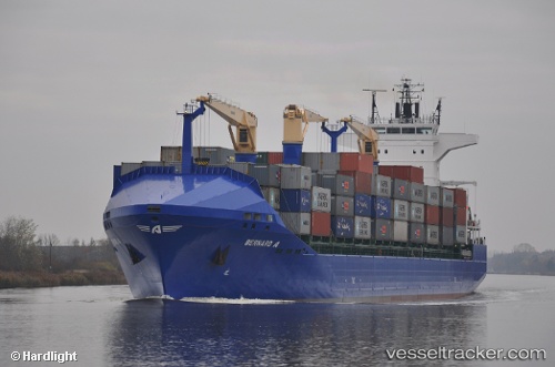
Vessel Bernard A IMO: 9415959, MMSI: 271040008 Container Ship
UTC, 38.48167, 24.88833, course: -1, speed: 13
UTC, 39.02439, 24.80610, course: 326, speed: 13.6
2026-02-04 07:39:56 UTC, 39.28333, 24.57167, course: -1, speed: 13
Live AIS position:
UTC. 23 nm N of Skíros),
updated 2026-02-04 07:39:56 UTC.
Find the position of the vessel Bernard A on the map. The latter are known coordinates and path.
marine traffic ship tracker show on live map
The current position of vessel Bernard A is 39.28333 lat / 24.57167 lng. Updated: 2026-02-04 07:39:56 UTCCurrently sailing under the flag of Turkey
Bernard A built in 2009 year
Deadweight:
21988 tDetails:
Last coordinates of the vessel:
UTC, 38.09056, 24.71963, course: 26, speed: 13.4UTC, 38.48167, 24.88833, course: -1, speed: 13
UTC, 39.02439, 24.80610, course: 326, speed: 13.6
2026-02-04 07:39:56 UTC, 39.28333, 24.57167, course: -1, speed: 13