 vesseltracker.com
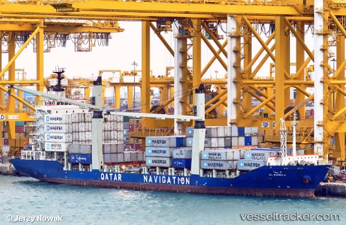
Vessel Al Rumeila IMO: 9416006, MMSI: 466057000 Container Ship
UTC, 25.02017, 55.04070, course: 157, speed: 7.9
UTC, 24.98213, 55.05486, course: 336, speed: 0.1
2026-02-10 22:19:38 UTC, 24.98209, 55.05485, course: 336, speed: 0
Live AIS position:
UTC. Near Jebel Ali Free Zone),
updated 2026-02-10 22:19:38 UTC.
Find the position of the vessel Al Rumeila on the map. The latter are known coordinates and path.
marine traffic ship tracker show on live map
The current position of vessel Al Rumeila is 24.98209 lat / 55.05485 lng. Updated: 2026-02-10 22:19:38 UTCCurrently sailing under the flag of Qatar
Al Rumeila built in 2009 year
Deadweight:
12524 tDetails:
Last coordinates of the vessel:
UTC, 25.13428, 54.98324, course: 146, speed: 4.7UTC, 25.02017, 55.04070, course: 157, speed: 7.9
UTC, 24.98213, 55.05486, course: 336, speed: 0.1
2026-02-10 22:19:38 UTC, 24.98209, 55.05485, course: 336, speed: 0