 vesseltracker.com
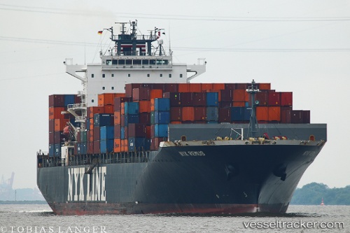
Vessel Nyk Remus IMO: 9416965, MMSI: 357175000 Container Ship
UTC, 51.10698, 1.59393, course: 225, speed: 10.7
UTC, 50.88231, 1.19448, course: 232, speed: 9
2026-01-24 03:27:06 UTC, 50.77055, 0.93053, course: 232, speed: 10
Live AIS position:
UTC. Near Dungeness),
updated 2026-01-24 03:27:06 UTC.
Find the position of the vessel Nyk Remus on the map. The latter are known coordinates and path.
marine traffic ship tracker show on live map
The current position of vessel Nyk Remus is 50.77055 lat / 0.93053 lng. Updated: 2026-01-24 03:27:06 UTCCurrently sailing under the flag of Panama
Nyk Remus built in 2009 year
Deadweight:
65981 tDetails:
Last coordinates of the vessel:
UTC, 51.32191, 1.87597, course: 205, speed: 12.8UTC, 51.10698, 1.59393, course: 225, speed: 10.7
UTC, 50.88231, 1.19448, course: 232, speed: 9
2026-01-24 03:27:06 UTC, 50.77055, 0.93053, course: 232, speed: 10