 vesseltracker.com
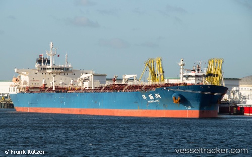
Vessel Yang Li Hu IMO: 9417177, MMSI: 413975000 Crude Oil Tanker
UTC, -27.38428, 153.16051, course: 202, speed: 0
UTC, -27.38434, 153.16052, course: 203, speed: 0
2026-02-13 04:29:11 UTC, -27.38433, 153.16049, course: 203, speed: 0
Live AIS position:
UTC. Near Chermside),
updated 2026-02-13 04:29:11 UTC.
Find the position of the vessel Yang Li Hu on the map. The latter are known coordinates and path.
marine traffic ship tracker show on live map
The current position of vessel Yang Li Hu is -27.38433 lat / 153.16049 lng. Updated: 2026-02-13 04:29:11 UTCDetails:
Last coordinates of the vessel:
UTC, -27.38433, 153.16052, course: 203, speed: 0UTC, -27.38428, 153.16051, course: 202, speed: 0
UTC, -27.38434, 153.16052, course: 203, speed: 0
2026-02-13 04:29:11 UTC, -27.38433, 153.16049, course: 203, speed: 0