 vesseltracker.com
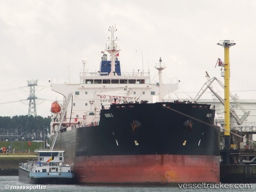
Vessel SUPER G IMO: 9418121, MMSI: 636023571 Chemical Oil Products Tanker
UTC, 41.36815, 29.25687, course: -1, speed: 6.7
UTC, 41.36589, 29.27993, course: -1, speed: 0.7
2026-02-26 22:26:31 UTC, 41.30821, 29.13942, course: -1, speed: 9.5
Live AIS position:
UTC. Near RUMELI FENERI),
updated 2026-02-26 22:26:31 UTC.
Find the position of the vessel SUPER G on the map. The latter are known coordinates and path.
marine traffic ship tracker show on live map
The current position of vessel SUPER G is 41.30821 lat / 29.13942 lng. Updated: 2026-02-26 22:26:31 UTCCurrently sailing under the flag of Liberia
SUPER G built in 2010 year
Deadweight:
50747 tDetails:
Last coordinates of the vessel:
UTC, 41.39152, 29.28280, course: -1, speed: 1.6UTC, 41.36815, 29.25687, course: -1, speed: 6.7
UTC, 41.36589, 29.27993, course: -1, speed: 0.7
2026-02-26 22:26:31 UTC, 41.30821, 29.13942, course: -1, speed: 9.5