 vesseltracker.com
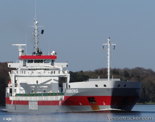
Vessel Finnborg IMO: 9419321, MMSI: 246824000 General Cargo Ship
UTC, 56.91003, 17.40458, course: 24, speed: 10.4
UTC, 57.24232, 17.64459, course: 25, speed: 10.6
2026-02-01 04:09:26 UTC, 57.53970, 17.89506, course: 30, speed: 10.5
Live AIS position:
UTC. Near Tofta),
updated 2026-02-01 04:09:26 UTC.
Find the position of the vessel Finnborg on the map. The latter are known coordinates and path.
marine traffic ship tracker show on live map
The current position of vessel Finnborg is 57.53970 lat / 17.89506 lng. Updated: 2026-02-01 04:09:26 UTCCurrently sailing under the flag of Netherlands
Finnborg built in 2011 year
Deadweight:
14603 tDetails:
Last coordinates of the vessel:
UTC, 56.56271, 17.15637, course: 22, speed: 10.1UTC, 56.91003, 17.40458, course: 24, speed: 10.4
UTC, 57.24232, 17.64459, course: 25, speed: 10.6
2026-02-01 04:09:26 UTC, 57.53970, 17.89506, course: 30, speed: 10.5