 vesseltracker.com
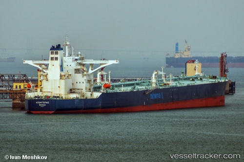
Vessel Apolytares IMO: 9419474, MMSI: 240878000 Crude Oil Tanker
UTC, 13.06167, 70.22833, course: -1, speed: 13
UTC, 12.71504, 70.39294, course: 154, speed: 13.3
2026-02-17 13:37:23 UTC, 12.22529, 70.64474, course: 157, speed: 13.1
Live AIS position:
UTC. 140 nm NW of Amini Island),
updated 2026-02-17 13:37:23 UTC.
Find the position of the vessel Apolytares on the map. The latter are known coordinates and path.
marine traffic ship tracker show on live map
The current position of vessel Apolytares is 12.22529 lat / 70.64474 lng. Updated: 2026-02-17 13:37:23 UTCDetails:
Last coordinates of the vessel:
UTC, 13.44500, 70.02500, course: -1, speed: 13UTC, 13.06167, 70.22833, course: -1, speed: 13
UTC, 12.71504, 70.39294, course: 154, speed: 13.3
2026-02-17 13:37:23 UTC, 12.22529, 70.64474, course: 157, speed: 13.1