 vesseltracker.com
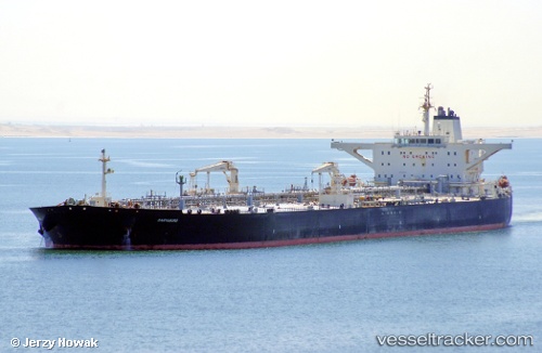
Vessel COMPASS IMO: 9422366, MMSI: 419002059 Tanker
UTC, 20.33500, 67.20833, course: -1, speed: 12
UTC, 20.10833, 67.85333, course: -1, speed: 13
2026-02-26 14:10:17 UTC, 20.06667, 67.96000, course: -1, speed: 13
Live AIS position:
UTC. 144 nm W of Veraval),
updated 2026-02-26 14:10:17 UTC.
Find the position of the vessel COMPASS on the map. The latter are known coordinates and path.
marine traffic ship tracker show on live map
The current position of vessel COMPASS is 20.06667 lat / 67.96000 lng. Updated: 2026-02-26 14:10:17 UTCCurrently sailing under the flag of India
Details:
Last coordinates of the vessel:
UTC, 20.43167, 67.00167, course: -1, speed: 13UTC, 20.33500, 67.20833, course: -1, speed: 12
UTC, 20.10833, 67.85333, course: -1, speed: 13
2026-02-26 14:10:17 UTC, 20.06667, 67.96000, course: -1, speed: 13