 vesseltracker.com
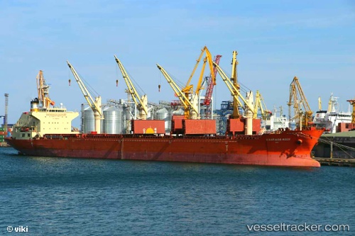
Vessel HOANG ANH 36 IMO: 9422495, MMSI: 352005709 Bulk Carrier
UTC, 16.97852, 82.31755, course: 339, speed: 0.2
UTC, 16.97855, 82.31716, course: 355, speed: 0
2026-02-24 08:25:32 UTC, 16.98122, 82.31602, course: 133, speed: 0.2
Live AIS position:
UTC. Near Kakinada),
updated 2026-02-24 08:25:32 UTC.
Find the position of the vessel HOANG ANH 36 on the map. The latter are known coordinates and path.
marine traffic ship tracker show on live map
The current position of vessel HOANG ANH 36 is 16.98122 lat / 82.31602 lng. Updated: 2026-02-24 08:25:32 UTCCurrently sailing under the flag of Panama
Details:
Last coordinates of the vessel:
UTC, 16.97890, 82.31790, course: 329, speed: 0UTC, 16.97852, 82.31755, course: 339, speed: 0.2
UTC, 16.97855, 82.31716, course: 355, speed: 0
2026-02-24 08:25:32 UTC, 16.98122, 82.31602, course: 133, speed: 0.2