 vesseltracker.com
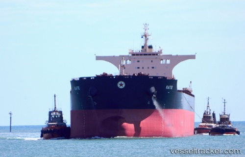
Vessel Kate IMO: 9427304, MMSI: 538004299 Bulk Carrier
UTC, 4.74807, 106.14977, course: 216, speed: 11.6
UTC, 4.41537, 105.90524, course: 214, speed: 11.3
2026-02-18 07:44:02 UTC, 4.06833, 105.67833, course: -1, speed: 11
Live AIS position:
UTC. 33 nm E of Belida Terminal),
updated 2026-02-18 07:44:02 UTC.
Find the position of the vessel Kate on the map. The latter are known coordinates and path.
marine traffic ship tracker show on live map
The current position of vessel Kate is 4.06833 lat / 105.67833 lng. Updated: 2026-02-18 07:44:02 UTCCurrently sailing under the flag of Marshall Is
Kate built in 2011 year
Deadweight:
176405 tDetails:
Last coordinates of the vessel:
UTC, 4.96954, 106.31256, course: 215, speed: 12UTC, 4.74807, 106.14977, course: 216, speed: 11.6
UTC, 4.41537, 105.90524, course: 214, speed: 11.3
2026-02-18 07:44:02 UTC, 4.06833, 105.67833, course: -1, speed: 11