 vesseltracker.com
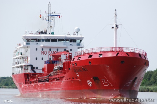
Vessel Prima IMO: 9427433, MMSI: 229450000 Chemical Oil Products Tanker
UTC, -13.66333, 41.07833, course: -1, speed: 1
UTC, -13.70412, 41.12922, course: 5, speed: 1.8
2026-02-01 01:59:02 UTC, -13.75333, 41.18167, course: -1, speed: 2
Live AIS position:
UTC. 56 nm NE of NACALA PORTO),
updated 2026-02-01 01:59:02 UTC.
Find the position of the vessel Prima on the map. The latter are known coordinates and path.
marine traffic ship tracker show on live map
The current position of vessel Prima is -13.75333 lat / 41.18167 lng. Updated: 2026-02-01 01:59:02 UTCDetails:
Last coordinates of the vessel:
UTC, -13.63573, 41.05339, course: 4, speed: 1.2UTC, -13.66333, 41.07833, course: -1, speed: 1
UTC, -13.70412, 41.12922, course: 5, speed: 1.8
2026-02-01 01:59:02 UTC, -13.75333, 41.18167, course: -1, speed: 2