 vesseltracker.com
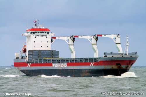
Vessel Jose Maria Espana IMO: 9429962, MMSI: 356441000 Multi Purpose Carrier
UTC, 31.37402, 121.69208, course: 117, speed: 0
UTC, 31.37333, 121.69167, course: -1, speed: 0
2026-02-01 21:41:44 UTC, 31.37402, 121.69208, course: 117, speed: 0
Live AIS position:
UTC. Near Gonglu),
updated 2026-02-01 21:41:44 UTC.
Find the position of the vessel Jose Maria Espana on the map. The latter are known coordinates and path.
marine traffic ship tracker show on live map
The current position of vessel Jose Maria Espana is 31.37402 lat / 121.69208 lng. Updated: 2026-02-01 21:41:44 UTCDetails:
Last coordinates of the vessel:
UTC, 31.37333, 121.69167, course: -1, speed: 0UTC, 31.37402, 121.69208, course: 117, speed: 0
UTC, 31.37333, 121.69167, course: -1, speed: 0
2026-02-01 21:41:44 UTC, 31.37402, 121.69208, course: 117, speed: 0