 vesseltracker.com
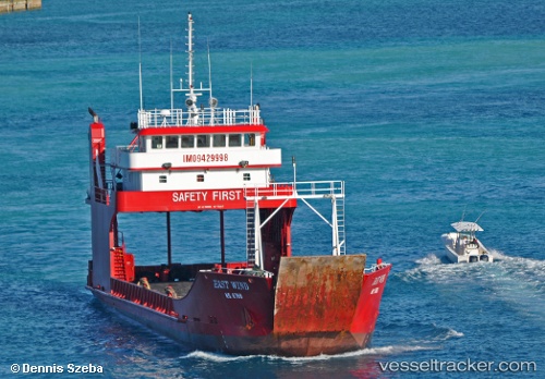
Vessel East Wind IMO: 9429998, MMSI: 352812000 Ro Ro Cargo Ship
UTC, 26.08645, -80.11985, course: -1, speed: 0.1
UTC, 26.25397, -79.89148, course: -1, speed: 12.5
2026-02-25 22:10:13 UTC, 26.35171, -79.78981, course: -1, speed: 11.3
Live AIS position:
UTC. 15 nm E of Hillsboro Beach),
updated 2026-02-25 22:10:13 UTC.
Find the position of the vessel East Wind on the map. The latter are known coordinates and path.
marine traffic ship tracker show on live map
The current position of vessel East Wind is 26.35171 lat / -79.78981 lng. Updated: 2026-02-25 22:10:13 UTCDetails:
Last coordinates of the vessel:
UTC, 26.08645, -80.11984, course: -1, speed: 0UTC, 26.08645, -80.11985, course: -1, speed: 0.1
UTC, 26.25397, -79.89148, course: -1, speed: 12.5
2026-02-25 22:10:13 UTC, 26.35171, -79.78981, course: -1, speed: 11.3