 vesseltracker.com
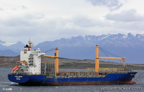
Vessel Perito Moreno IMO: 9430868, MMSI: 636017683 Container Ship
UTC, 16.19553, -61.53577, course: 203, speed: 14.7
UTC, 15.93333, -61.62667, course: -1, speed: 12
2026-02-13 22:11:31 UTC, 15.98167, -62.20500, course: -1, speed: 12
Live AIS position:
UTC. 27 nm W of Bouillante),
updated 2026-02-13 22:11:31 UTC.
Find the position of the vessel Perito Moreno on the map. The latter are known coordinates and path.
marine traffic ship tracker show on live map
The current position of vessel Perito Moreno is 15.98167 lat / -62.20500 lng. Updated: 2026-02-13 22:11:31 UTCCurrently sailing under the flag of Liberia
Perito Moreno built in 2009 year
Deadweight:
23294 tDetails:
Last coordinates of the vessel:
UTC, 16.22846, -61.54540, course: 53, speed: 0UTC, 16.19553, -61.53577, course: 203, speed: 14.7
UTC, 15.93333, -61.62667, course: -1, speed: 12
2026-02-13 22:11:31 UTC, 15.98167, -62.20500, course: -1, speed: 12