 vesseltracker.com
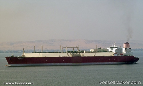
Vessel Al Khattiya IMO: 9431111, MMSI: 538003350 Lng Tanker
UTC, 7.24421, 96.68282, course: -1, speed: 15.3
UTC, 7.16833, 97.06333, course: -1, speed: 13
2026-03-24 07:59:23 UTC, 7.31167, 97.13333, course: -1, speed: 0
Live Vessel Al Khattiya Analytics (details, animations, etc.)
Live AIS position: UTC. 81 nm W of Phuket Port), updated 2026-03-24 07:59:23 UTC.Find the position of the vessel Al Khattiya on the map. The latter are known coordinates and path.
marine traffic ship tracker show on live map
The current position of vessel Al Khattiya is 7.31167 lat / 97.13333 lng. Updated: 2026-03-24 07:59:23 UTCDetails:
Last coordinates of the vessel:
UTC, 7.36167, 96.14333, course: -1, speed: 14UTC, 7.24421, 96.68282, course: -1, speed: 15.3
UTC, 7.16833, 97.06333, course: -1, speed: 13
2026-03-24 07:59:23 UTC, 7.31167, 97.13333, course: -1, speed: 0