 vesseltracker.com
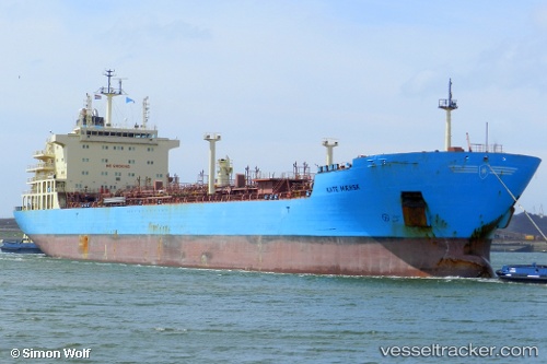
Vessel Maersk Kate IMO: 9431276, MMSI: 566582000 Chemical Oil Products Tanker
UTC, 37.20320, -6.93940, course: 167, speed: 0.1
UTC, 37.20320, -6.93939, course: 167, speed: 0
2026-01-20 03:41:41 UTC, 37.20317, -6.93938, course: 167, speed: 0
Live AIS position:
UTC. Near Punta Umbría),
updated 2026-01-20 03:41:41 UTC.
Find the position of the vessel Maersk Kate on the map. The latter are known coordinates and path.
marine traffic ship tracker show on live map
The current position of vessel Maersk Kate is 37.20317 lat / -6.93938 lng. Updated: 2026-01-20 03:41:41 UTCCurrently sailing under the flag of Singapore
Maersk Kate built in 2010 year
Deadweight:
39756 tDetails:
Last coordinates of the vessel:
UTC, 37.20319, -6.93939, course: 167, speed: 0UTC, 37.20320, -6.93940, course: 167, speed: 0.1
UTC, 37.20320, -6.93939, course: 167, speed: 0
2026-01-20 03:41:41 UTC, 37.20317, -6.93938, course: 167, speed: 0