 vesseltracker.com
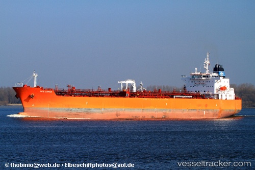
Vessel Hsl Anna IMO: 9434216, MMSI: 636017987 Chemical Oil Products Tanker
UTC, 22.51960, 38.08630, course: 121, speed: 34.2
UTC, 19.43987, 39.28929, course: 44, speed: 50.8
2026-02-09 07:40:05 UTC, 22.69285, 38.11179, course: 345, speed: 1.1
Live AIS position:
UTC. 43 nm W of Gialtra),
updated 2026-02-09 07:40:05 UTC.
Find the position of the vessel Hsl Anna on the map. The latter are known coordinates and path.
marine traffic ship tracker show on live map
The current position of vessel Hsl Anna is 22.69285 lat / 38.11179 lng. Updated: 2026-02-09 07:40:05 UTCCurrently sailing under the flag of Liberia
Hsl Anna built in 2010 year
Deadweight:
51747 tDetails:
Last coordinates of the vessel:
UTC, 22.51960, 38.08630, course: 121, speed: 34.2UTC, 22.51960, 38.08630, course: 121, speed: 34.2
UTC, 19.43987, 39.28929, course: 44, speed: 50.8
2026-02-09 07:40:05 UTC, 22.69285, 38.11179, course: 345, speed: 1.1