 vesseltracker.com
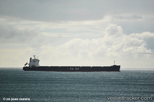
Vessel Yasa H.mulla IMO: 9442512, MMSI: 271042868 Bulk Carrier
UTC, -30.87054, 39.00425, course: 234, speed: 10.9
UTC, -31.01063, 38.49268, course: 268, speed: 12.8
2026-02-14 21:20:07 UTC, -31.02042, 38.13222, course: 267, speed: 11.6
Live AIS position:
UTC. 338 nm SE of Richards Bay),
updated 2026-02-14 21:20:07 UTC.
Find the position of the vessel Yasa H.mulla on the map. The latter are known coordinates and path.
marine traffic ship tracker show on live map
The current position of vessel Yasa H.mulla is -31.02042 lat / 38.13222 lng. Updated: 2026-02-14 21:20:07 UTCDetails:
Last coordinates of the vessel:
UTC, -30.76725, 39.22128, course: 238, speed: 10.3UTC, -30.87054, 39.00425, course: 234, speed: 10.9
UTC, -31.01063, 38.49268, course: 268, speed: 12.8
2026-02-14 21:20:07 UTC, -31.02042, 38.13222, course: 267, speed: 11.6