 vesseltracker.com
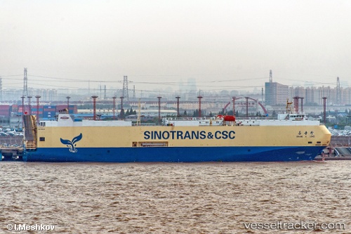
Vessel Chang Ji Long IMO: 9442586, MMSI: 413463060 Vehicles Carrier
UTC, 22.12511, 114.08024, course: 92, speed: 14.9
UTC, 22.11385, 114.66636, course: 90, speed: 14.1
2026-02-15 22:06:16 UTC, 22.12933, 115.16592, course: 86, speed: 14
Live AIS position:
UTC. 33 nm SE of Pinghai),
updated 2026-02-15 22:06:16 UTC.
Find the position of the vessel Chang Ji Long on the map. The latter are known coordinates and path.
marine traffic ship tracker show on live map
The current position of vessel Chang Ji Long is 22.12933 lat / 115.16592 lng. Updated: 2026-02-15 22:06:16 UTCCurrently sailing under the flag of China
Chang Ji Long built in 2009 year
Deadweight:
5594 tDetails:
Last coordinates of the vessel:
UTC, 22.40887, 113.75991, course: 173, speed: 14UTC, 22.12511, 114.08024, course: 92, speed: 14.9
UTC, 22.11385, 114.66636, course: 90, speed: 14.1
2026-02-15 22:06:16 UTC, 22.12933, 115.16592, course: 86, speed: 14