 vesseltracker.com
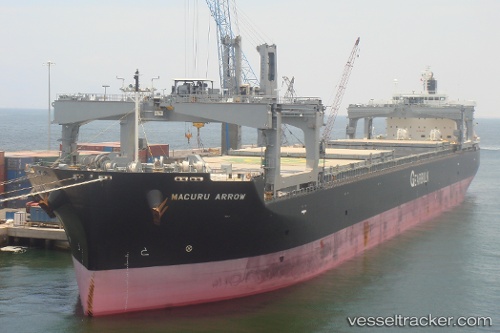
Vessel Macuru Arrow IMO: 9443918, MMSI: 311032500 Bulk Carrier
UTC, 10.18886, 107.03714, course: 331, speed: 0.8
UTC, 10.18965, 107.03493, course: 39, speed: 0.1
2026-02-22 01:30:09 UTC, 10.18957, 107.03490, course: 39, speed: 0.3
Live AIS position:
UTC. Near Cape St. Jacques),
updated 2026-02-22 01:30:09 UTC.
Find the position of the vessel Macuru Arrow on the map. The latter are known coordinates and path.
marine traffic ship tracker show on live map
The current position of vessel Macuru Arrow is 10.18957 lat / 107.03490 lng. Updated: 2026-02-22 01:30:09 UTCDetails:
Last coordinates of the vessel:
UTC, 10.23542, 107.26840, course: 296, speed: 14.6UTC, 10.18886, 107.03714, course: 331, speed: 0.8
UTC, 10.18965, 107.03493, course: 39, speed: 0.1
2026-02-22 01:30:09 UTC, 10.18957, 107.03490, course: 39, speed: 0.3