 vesseltracker.com
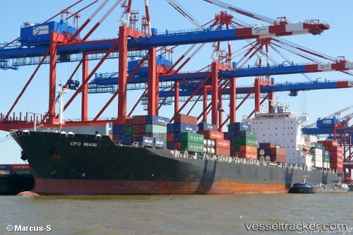
Vessel Navios Miami IMO: 9445588, MMSI: 636018904 Container Ship
UTC, -10.54833, 139.74500, course: -1, speed: 1
UTC, -10.59045, 139.77550, course: 25, speed: 1.2
2026-02-16 08:15:04 UTC, -10.62550, 139.79126, course: 25, speed: 0.7
Live AIS position:
UTC. 125 nm W of Booby Island),
updated 2026-02-16 08:15:04 UTC.
Find the position of the vessel Navios Miami on the map. The latter are known coordinates and path.
marine traffic ship tracker show on live map
The current position of vessel Navios Miami is -10.62550 lat / 139.79126 lng. Updated: 2026-02-16 08:15:04 UTCDetails:
Last coordinates of the vessel:
UTC, -10.48833, 139.41167, course: -1, speed: 13UTC, -10.54833, 139.74500, course: -1, speed: 1
UTC, -10.59045, 139.77550, course: 25, speed: 1.2
2026-02-16 08:15:04 UTC, -10.62550, 139.79126, course: 25, speed: 0.7