 vesseltracker.com
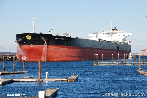
Vessel Mare Doricum IMO: 9446374, MMSI: 247275900 Crude Oil Tanker
UTC, -12.89651, 58.16597, course: 180, speed: 12.6
UTC, -13.22950, 58.13022, course: 181, speed: 13
2026-01-18 20:28:29 UTC, -13.44116, 58.10476, course: 181, speed: 12.6
Live AIS position:
UTC. 394 nm N of Cap Malheureux),
updated 2026-01-18 20:28:29 UTC.
Find the position of the vessel Mare Doricum on the map. The latter are known coordinates and path.
marine traffic ship tracker show on live map
The current position of vessel Mare Doricum is -13.44116 lat / 58.10476 lng. Updated: 2026-01-18 20:28:29 UTCDetails:
Last coordinates of the vessel:
UTC, -12.51832, 58.20911, course: 181, speed: 13.1UTC, -12.89651, 58.16597, course: 180, speed: 12.6
UTC, -13.22950, 58.13022, course: 181, speed: 13
2026-01-18 20:28:29 UTC, -13.44116, 58.10476, course: 181, speed: 12.6