 vesseltracker.com
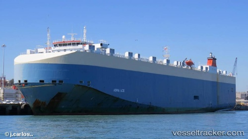
Vessel Adria Ace IMO: 9446881, MMSI: 311003900 Vehicles Carrier
UTC, 50.80719, -170.97285, course: 81, speed: 17.8
UTC, 50.91488, -169.94962, course: 83, speed: 17.5
2026-01-23 01:51:06 UTC, 51.20603, -163.58420, course: 86, speed: 17.8
Live AIS position:
UTC. 158 nm N of Achau),
updated 2026-01-23 01:51:06 UTC.
Find the position of the vessel Adria Ace on the map. The latter are known coordinates and path.
marine traffic ship tracker show on live map
The current position of vessel Adria Ace is 51.20603 lat / -163.58420 lng. Updated: 2026-01-23 01:51:06 UTCDetails:
Last coordinates of the vessel:
UTC, 30.53333, 165.07333, course: -1, speed: 16UTC, 50.80719, -170.97285, course: 81, speed: 17.8
UTC, 50.91488, -169.94962, course: 83, speed: 17.5
2026-01-23 01:51:06 UTC, 51.20603, -163.58420, course: 86, speed: 17.8