 vesseltracker.com
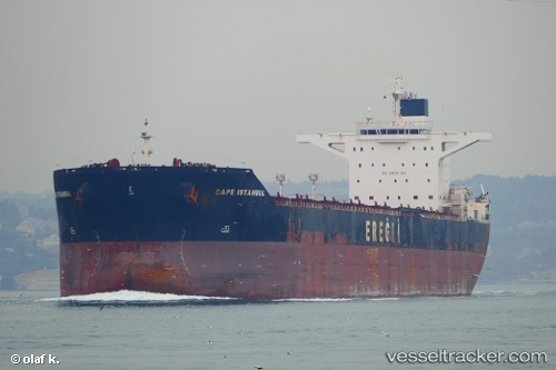
Vessel Cape Istanbul IMO: 9446908, MMSI: 538004220 Bulk Carrier
UTC, 2.64887, 141.30431, course: 138, speed: 12.9
UTC, 2.31265, 141.63249, course: 142, speed: 13
2026-02-26 09:42:12 UTC, 1.98563, 141.87564, course: 138, speed: 13.1
Live AIS position:
UTC. 270 nm NE of Sarmi),
updated 2026-02-26 09:42:12 UTC.
Find the position of the vessel Cape Istanbul on the map. The latter are known coordinates and path.
marine traffic ship tracker show on live map
The current position of vessel Cape Istanbul is 1.98563 lat / 141.87564 lng. Updated: 2026-02-26 09:42:12 UTCDetails:
Last coordinates of the vessel:
UTC, 2.93361, 141.05788, course: 141, speed: 12.3UTC, 2.64887, 141.30431, course: 138, speed: 12.9
UTC, 2.31265, 141.63249, course: 142, speed: 13
2026-02-26 09:42:12 UTC, 1.98563, 141.87564, course: 138, speed: 13.1