 vesseltracker.com
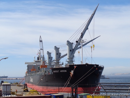
Vessel Avocet Arrow IMO: 9448255, MMSI: 311000462 Bulk Carrier
UTC, 38.06767, 16.70878, course: 219, speed: 12.3
UTC, 37.60631, 16.22209, course: 221, speed: 12.4
2026-02-08 10:05:30 UTC, 37.31777, 15.91526, course: 217, speed: 12.4
Live AIS position:
UTC. 14 nm NE of Licodia Eubea),
updated 2026-02-08 10:05:30 UTC.
Find the position of the vessel Avocet Arrow on the map. The latter are known coordinates and path.
marine traffic ship tracker show on live map
The current position of vessel Avocet Arrow is 37.31777 lat / 15.91526 lng. Updated: 2026-02-08 10:05:30 UTCCurrently sailing under the flag of Bahamas
Details:
Last coordinates of the vessel:
UTC, 38.34167, 16.99333, course: -1, speed: 12UTC, 38.06767, 16.70878, course: 219, speed: 12.3
UTC, 37.60631, 16.22209, course: 221, speed: 12.4
2026-02-08 10:05:30 UTC, 37.31777, 15.91526, course: 217, speed: 12.4