 vesseltracker.com
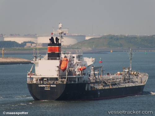
Vessel Chemstar Masa IMO: 9451410, MMSI: 353456000 Chemical Oil Products Tanker
UTC, 2.16905, 104.82428, course: 0, speed: 3.4
UTC, 2.35507, 104.86880, course: 223, speed: 1.5
2026-02-24 00:22:54 UTC, 2.33763, 104.84958, course: 285, speed: 0.9
Live AIS position:
UTC. 72 nm NE of Kampung Tanjung Langsat),
updated 2026-02-24 00:22:54 UTC.
Find the position of the vessel Chemstar Masa on the map. The latter are known coordinates and path.
marine traffic ship tracker show on live map
The current position of vessel Chemstar Masa is 2.33763 lat / 104.84958 lng. Updated: 2026-02-24 00:22:54 UTCDetails:
Last coordinates of the vessel:
UTC, 2.16155, 104.81255, course: 287, speed: 1.7UTC, 2.16905, 104.82428, course: 0, speed: 3.4
UTC, 2.35507, 104.86880, course: 223, speed: 1.5
2026-02-24 00:22:54 UTC, 2.33763, 104.84958, course: 285, speed: 0.9