 vesseltracker.com
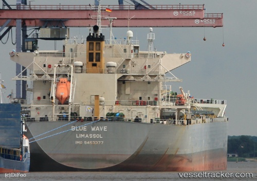
Vessel Blue Wave IMO: 9453377, MMSI: 209722000 Bulk Carrier
UTC, 16.52422, 117.67390, course: 227, speed: 12.3
UTC, 16.35548, 117.48350, course: 228, speed: 12.2
2026-02-09 06:17:35 UTC, 16.00667, 117.05500, course: -1, speed: 12
Live AIS position:
UTC. 165 nm W of Bolinao),
updated 2026-02-09 06:17:35 UTC.
Find the position of the vessel Blue Wave on the map. The latter are known coordinates and path.
marine traffic ship tracker show on live map
The current position of vessel Blue Wave is 16.00667 lat / 117.05500 lng. Updated: 2026-02-09 06:17:35 UTCDetails:
Last coordinates of the vessel:
UTC, 16.81243, 118.01848, course: 227, speed: 12.2UTC, 16.52422, 117.67390, course: 227, speed: 12.3
UTC, 16.35548, 117.48350, course: 228, speed: 12.2
2026-02-09 06:17:35 UTC, 16.00667, 117.05500, course: -1, speed: 12