 vesseltracker.com
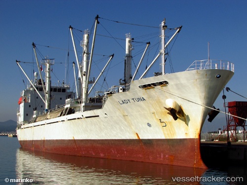
Vessel Lady Tuna IMO: 9453418, MMSI: 374762000 Refrigerated Cargo Ship
UTC, -33.90519, 18.28162, course: 211, speed: 13.2
UTC, -34.28230, 18.20496, course: 181, speed: 12.4
2026-02-22 01:59:41 UTC, -34.49001, 18.46012, course: 113, speed: 11.3
Live AIS position:
UTC. Near Cape Of Good Hope),
updated 2026-02-22 01:59:41 UTC.
Find the position of the vessel Lady Tuna on the map. The latter are known coordinates and path.
marine traffic ship tracker show on live map
The current position of vessel Lady Tuna is -34.49001 lat / 18.46012 lng. Updated: 2026-02-22 01:59:41 UTCDetails:
Last coordinates of the vessel:
UTC, -33.91642, 18.44318, course: 311, speed: 0UTC, -33.90519, 18.28162, course: 211, speed: 13.2
UTC, -34.28230, 18.20496, course: 181, speed: 12.4
2026-02-22 01:59:41 UTC, -34.49001, 18.46012, course: 113, speed: 11.3