 vesseltracker.com
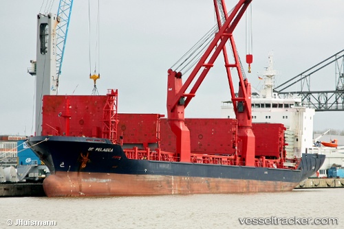
Vessel Pelagica IMO: 9453781, MMSI: 566222000 Multi Purpose Carrier
UTC, 38.60932, 12.08727, course: 280, speed: 9.9
UTC, 38.71737, 11.37591, course: 281, speed: 10.7
2026-01-31 04:16:54 UTC, 38.80054, 10.79233, course: 279, speed: 11.1
Live AIS position:
UTC. 62 nm E of Cape Carbonara),
updated 2026-01-31 04:16:54 UTC.
Find the position of the vessel Pelagica on the map. The latter are known coordinates and path.
marine traffic ship tracker show on live map
The current position of vessel Pelagica is 38.80054 lat / 10.79233 lng. Updated: 2026-01-31 04:16:54 UTCCurrently sailing under the flag of Singapore
Pelagica built in 2010 year
Deadweight:
12737 tDetails:
Last coordinates of the vessel:
UTC, 38.58325, 12.32991, course: 280, speed: 10.6UTC, 38.60932, 12.08727, course: 280, speed: 9.9
UTC, 38.71737, 11.37591, course: 281, speed: 10.7
2026-01-31 04:16:54 UTC, 38.80054, 10.79233, course: 279, speed: 11.1