 vesseltracker.com
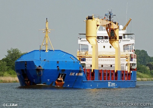
Vessel Bbc Marmara IMO: 9454228, MMSI: 255806141 Multi Purpose Carrier
UTC, -7.27500, 136.56168, course: -1, speed: 10
UTC, -6.98884, 136.58534, course: 8, speed: 8.7
2026-02-05 09:32:10 UTC, -6.68219, 136.61000, course: 359, speed: 8.5
Live AIS position:
UTC. 113 nm S of Pomako),
updated 2026-02-05 09:32:10 UTC.
Find the position of the vessel Bbc Marmara on the map. The latter are known coordinates and path.
marine traffic ship tracker show on live map
The current position of vessel Bbc Marmara is -6.68219 lat / 136.61000 lng. Updated: 2026-02-05 09:32:10 UTCCurrently sailing under the flag of Portugal
Bbc Marmara built in 2010 year
Deadweight:
6203 tDetails:
Last coordinates of the vessel:
UTC, -7.51500, 136.54666, course: -1, speed: 11UTC, -7.27500, 136.56168, course: -1, speed: 10
UTC, -6.98884, 136.58534, course: 8, speed: 8.7
2026-02-05 09:32:10 UTC, -6.68219, 136.61000, course: 359, speed: 8.5