 vesseltracker.com
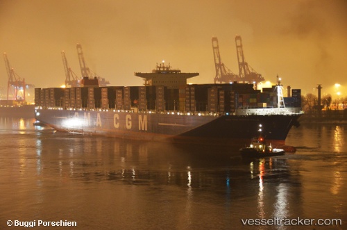
Vessel Cma Cgm Marco Polo IMO: 9454436, MMSI: 311000923 Container Ship
UTC, 22.50037, 116.53660, course: 251, speed: 18
UTC, 22.28472, 116.01908, course: 237, speed: 17.8
2026-01-25 05:47:39 UTC, 22.45202, 113.89170, course: 37, speed: 0
Live AIS position:
UTC. Near Mawan Pt),
updated 2026-01-25 05:47:39 UTC.
Find the position of the vessel Cma Cgm Marco Polo on the map. The latter are known coordinates and path.
marine traffic ship tracker show on live map
The current position of vessel Cma Cgm Marco Polo is 22.45202 lat / 113.89170 lng. Updated: 2026-01-25 05:47:39 UTCDetails:
Last coordinates of the vessel:
UTC, 22.74559, 117.08745, course: 228, speed: 18.5UTC, 22.50037, 116.53660, course: 251, speed: 18
UTC, 22.28472, 116.01908, course: 237, speed: 17.8
2026-01-25 05:47:39 UTC, 22.45202, 113.89170, course: 37, speed: 0