 vesseltracker.com
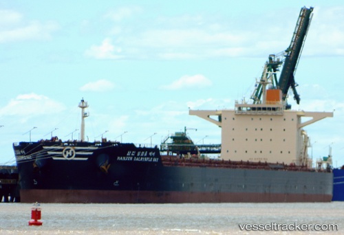
Vessel Hl Dalrymple Bay IMO: 9458389, MMSI: 370216000 Bulk Carrier
UTC, 9.55192, 110.85242, course: 216, speed: 12.9
UTC, 9.18832, 110.58772, course: 214, speed: 13
2026-02-12 09:12:50 UTC, 9.05490, 110.48983, course: 214, speed: 13
Live AIS position:
UTC. 93 nm N of Colomadu),
updated 2026-02-12 09:12:50 UTC.
Find the position of the vessel Hl Dalrymple Bay on the map. The latter are known coordinates and path.
marine traffic ship tracker show on live map
The current position of vessel Hl Dalrymple Bay is 9.05490 lat / 110.48983 lng. Updated: 2026-02-12 09:12:50 UTCCurrently sailing under the flag of Panama
Hl Dalrymple Bay built in 2010 year
Deadweight:
179147 tDetails:
Last coordinates of the vessel:
UTC, 10.30713, 111.40828, course: 222, speed: 13.7UTC, 9.55192, 110.85242, course: 216, speed: 12.9
UTC, 9.18832, 110.58772, course: 214, speed: 13
2026-02-12 09:12:50 UTC, 9.05490, 110.48983, course: 214, speed: 13