 vesseltracker.com
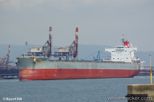
Vessel Hakuta IMO: 9461221, MMSI: 372779000 Bulk Carrier
UTC, 28.63333, 124.48667, course: -1, speed: 12
UTC, 28.19747, 124.74804, course: 152, speed: 12.7
2026-01-30 17:57:57 UTC, 27.75500, 125.01667, course: -1, speed: 11
Live AIS position:
UTC. 123 nm NW of Kumejima),
updated 2026-01-30 17:57:57 UTC.
Find the position of the vessel Hakuta on the map. The latter are known coordinates and path.
marine traffic ship tracker show on live map
The current position of vessel Hakuta is 27.75500 lat / 125.01667 lng. Updated: 2026-01-30 17:57:57 UTCDetails:
Last coordinates of the vessel:
UTC, 28.93500, 124.31167, course: -1, speed: 12UTC, 28.63333, 124.48667, course: -1, speed: 12
UTC, 28.19747, 124.74804, course: 152, speed: 12.7
2026-01-30 17:57:57 UTC, 27.75500, 125.01667, course: -1, speed: 11