 vesseltracker.com
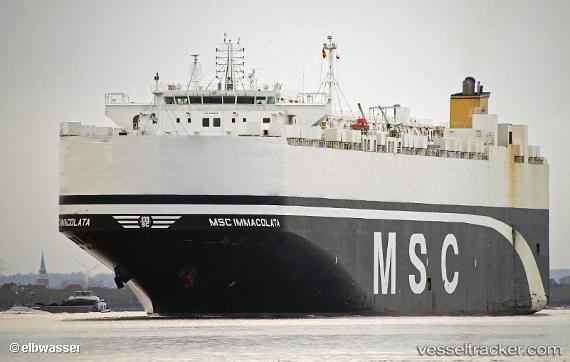
Vessel Msc Immacolata IMO: 9463205, MMSI: 373124000 Vehicles Carrier
UTC, 16.22009, 116.07157, course: 226, speed: 15.4
UTC, 15.85094, 115.69010, course: 226, speed: 14.5
2026-02-23 06:32:00 UTC, 15.38820, 115.25190, course: 220, speed: 14.5
Live AIS position:
UTC. 273 nm W of Iba),
updated 2026-02-23 06:32:00 UTC.
Find the position of the vessel Msc Immacolata on the map. The latter are known coordinates and path.
marine traffic ship tracker show on live map
The current position of vessel Msc Immacolata is 15.38820 lat / 115.25190 lng. Updated: 2026-02-23 06:32:00 UTCCurrently sailing under the flag of Panama
Msc Immacolata built in 2012 year
Deadweight:
22196 tDetails:
Last coordinates of the vessel:
UTC, 16.70193, 116.55350, course: 220, speed: 14.6UTC, 16.22009, 116.07157, course: 226, speed: 15.4
UTC, 15.85094, 115.69010, course: 226, speed: 14.5
2026-02-23 06:32:00 UTC, 15.38820, 115.25190, course: 220, speed: 14.5