.
vessel Aquamarine IMO: 9469546, Bulk Carrier
vesseltracker.com
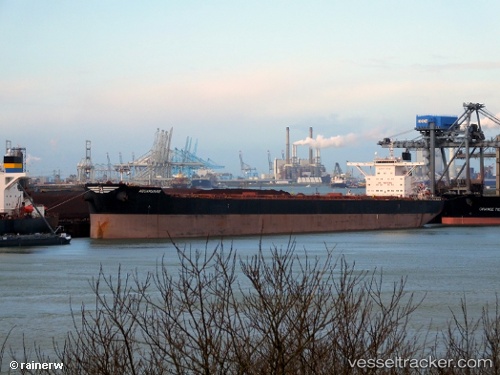
Vessel Aquamarine IMO: 9469546, MMSI: 636014441 Bulk Carrier

callsign: A8TV9
size: 45x292

Live AIS position: UTC. 56 nm SE of Tan Cang Qui Nhon), updated 2026-01-18 18:36:00 UTC.

Find the position of the vessel Aquamarine on the map. The latter are known coordinates and path.

marine traffic ship tracker show on live map

The current position of vessel Aquamarine is 13.03750 lat / 110.42348 lng. Updated: 2026-01-18 18:36:00 UTC
Details:


Last coordinates of the vessel:
UTC, 12.04597, 110.59832, course: 9, speed: 9.5
UTC, 12.80732, 110.47012, course: 350, speed: 9.8
2026-01-18 18:36:00 UTC, 13.03750, 110.42348, course: 350, speed: 9.6


Most frequent ports a vessels calls at Aquamarine (636014441):

Sambu, traffic: 10
Singapore, traffic: 7
Bur Ibrahim, traffic: 6
Takoradi, traffic: 4
Sekondi, traffic: 4
Selat Lombok, traffic: 4
Port Said, traffic: 4
Colon, traffic: 3
PENGERANG, traffic: 3
Cristobal, traffic: 3
Dagu Bar, traffic: 3
Ra’S Shukhayr, traffic: 3
PULAU SAMBU, traffic: 3
Ta-Ku, traffic: 2
Taku Bar, traffic: 2

Link to the map:


Find another ship

Aquamarine (636014441) last ports (portcalls and passsages)

JURONG ISLAND | 2025-05-25 08:38:13
PULAU SAMBU | 2025-05-25 07:01:09
TANAH MERAH | 2025-05-24 14:05:54
PENGERANG | 2025-05-24 11:04:50
SURALAYA | 2025-04-12 03:02:21
Takoradi | 2025-03-10 14:26:41
Takoradi | 2025-03-06 13:15:18
Takoradi | 2025-03-02 12:50:08
Takoradi | 2025-02-26 11:58:37
PULAU SAMBU | 2025-01-25 22:36:03
Sambu | 2025-01-25 21:55:19
BATU AMPAR | 2025-01-25 21:25:58
TANAH MERAH | 2025-01-25 05:26:47
PENGERANG | 2025-01-25 02:15:33
Taku Bar | 2025-01-15 22:43:57
Dagu Bar | 2025-01-15 22:03:53
Ta-Ku | 2025-01-15 19:48:03
Ta-Ku | 2025-01-11 19:39:07
Dagu Bar | 2025-01-11 17:09:29
Taku Bar | 2025-01-11 16:27:07
PENGERANG | 2024-12-26 11:07:36
PULAU SAMBU | 2024-12-26 09:25:00
RAS SHUKHEIR | 2024-12-06 06:09:27
Ras Gharib | 2024-12-06 04:57:11
AL ADABIYAH | 2024-12-05 19:29:02
SUEZ CANAL | 2024-12-05 14:56:14
ISMAILIA | 2024-12-05 13:25:50
Port Said | 2024-12-05 07:53:40
Iskenderun | 2024-11-27 01:49:35
Port Said | 2024-11-25 14:43:50
SUEZ CANAL | 2024-11-25 08:07:52
SUEZ PORT | 2024-11-25 04:38:46
Singapore | 2024-10-28 05:11:59
Selat Lombok | 2024-07-29 07:11:00
Selat Lombok | 2024-06-06 01:23:31
Dagu Bar | 2024-04-13 18:38:01
Sambu | 2024-03-27 22:35:11
Ra’S Shukhayr | 2024-03-06 13:14:41
Ayn Sukhnah | 2024-03-06 03:04:11
Bur Ibrahim | 2024-03-05 23:59:49
Port Said | 2024-03-05 13:44:25
Canakkale | 2024-03-01 10:24:17
Gelibolu | 2024-03-01 08:22:10
Uskudar | 2024-02-28 07:07:48
Uskudar | 2024-02-12 08:24:41
Gelibolu | 2024-02-11 01:56:55
Canakkale | 2024-02-10 23:13:45
Port Said | 2024-02-07 14:48:12
Bur Ibrahim | 2024-02-07 05:10:09
Ra’S Shukhayr | 2024-02-06 09:59:25
Richards Bay | 2023-12-24 03:24:17
Sambu | 2023-12-06 10:38:18
Singapore | 2023-12-05 01:11:29
Zhangjiagang | 2023-11-25 08:47:27
Nantong | 2023-11-25 06:28:57
Taicang | 2023-11-25 04:13:06
Wusong | 2023-11-25 01:44:31
Sambu | 2023-11-04 16:40:49
Singapore | 2023-09-10 08:18:21
Taboneo | 2023-09-04 01:39:15
Taboneo | 2023-08-31 00:50:05
Tsugaru-Kaikyo | 2023-07-19 01:16:00
Morro Redondo | 2023-06-25 11:11:25
Busan | 2023-06-04 16:06:46
Tsugaru-Kaikyo | 2023-05-18 15:38:12
Panama | 2023-04-17 03:52:59
Balboa | 2023-04-16 22:54:35
Cristobal | 2023-04-13 11:20:19
Cristobal | 2023-04-09 10:50:28
Cristobal | 2023-04-02 12:18:09
Annapolis | 2023-03-23 23:05:12
Annapolis | 2023-03-19 20:31:41
Baltimore | 2023-03-17 05:58:17
Strait Of Gibraltar | 2023-02-22 18:05:04
Algeciras | 2023-02-21 23:37:53
Bur Ibrahim | 2023-02-12 08:37:23
Dampier | 2022-11-18 08:01:31
Lianyungang | 2022-09-02 04:34:00
Singapore | 2022-07-03 10:15:53
Singapore | 2022-02-24 21:36:36
Selat Lombok | 2021-12-26 01:07:38
Samson Point | 2021-12-02 05:50:54