 vesseltracker.com
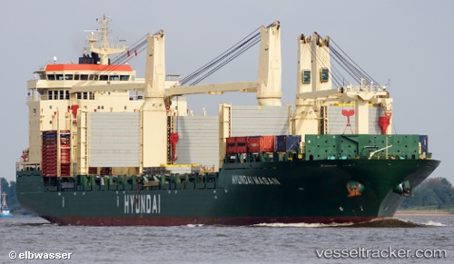
Vessel Hyundai Masan IMO: 9469883, MMSI: 538004065 Multi Purpose Carrier
UTC, 7.77167, -91.56500, course: -1, speed: 17
UTC, 7.76167, -92.01500, course: -1, speed: 17
2026-02-13 08:14:56 UTC, 7.74086, -92.78989, course: 269, speed: 17.2
Live AIS position:
UTC. 306 nm NE of Sweeny),
updated 2026-02-13 08:14:56 UTC.
Find the position of the vessel Hyundai Masan on the map. The latter are known coordinates and path.
marine traffic ship tracker show on live map
The current position of vessel Hyundai Masan is 7.74086 lat / -92.78989 lng. Updated: 2026-02-13 08:14:56 UTCDetails:
Last coordinates of the vessel:
UTC, 7.78420, -91.05858, course: 270, speed: 17.9UTC, 7.77167, -91.56500, course: -1, speed: 17
UTC, 7.76167, -92.01500, course: -1, speed: 17
2026-02-13 08:14:56 UTC, 7.74086, -92.78989, course: 269, speed: 17.2