 vesseltracker.com
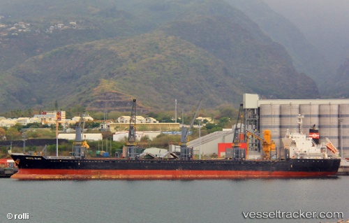
Vessel LADY MIRAF IMO: 9470325, MMSI: 311001052 Bulk Carrier
Live AIS position:
UTC. Near Saint Brelade),
updated 2025-12-28 17:32:46 UTC.
Find the position of the vessel LADY MIRAF on the map. The latter are known coordinates and path.
marine traffic ship tracker show on live map
The current position of vessel LADY MIRAF is 49.18931 lat / -2.41692 lng. Updated: 2025-12-28 17:32:46 UTCCurrently sailing under the flag of Bahamas
LADY MIRAF built in 2011 year
Deadweight:
28228 tDetails:
Last coordinates of the vessel:
2025-12-28 17:32:46 UTC, 49.18931, -2.41692, course: 164, speed: 36.2