 vesseltracker.com
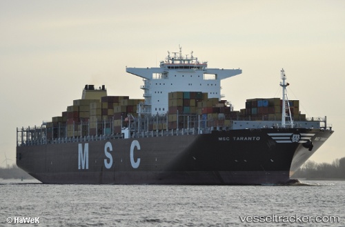
Vessel Msc Taranto IMO: 9475258, MMSI: 636092247 Container Ship
UTC, -30.83213, 34.29033, course: 247, speed: 19
UTC, -31.20833, 33.26333, course: -1, speed: 19
2026-02-07 07:56:39 UTC, -31.43921, 32.68731, course: 248, speed: 19.7
Live AIS position:
UTC. 120 nm SE of Hibberdene),
updated 2026-02-07 07:56:39 UTC.
Find the position of the vessel Msc Taranto on the map. The latter are known coordinates and path.
marine traffic ship tracker show on live map
The current position of vessel Msc Taranto is -31.43921 lat / 32.68731 lng. Updated: 2026-02-07 07:56:39 UTCCurrently sailing under the flag of Liberia
Msc Taranto built in 2011 year
Deadweight:
166085 tDetails:
Last coordinates of the vessel:
UTC, -30.71333, 34.59500, course: -1, speed: 19UTC, -30.83213, 34.29033, course: 247, speed: 19
UTC, -31.20833, 33.26333, course: -1, speed: 19
2026-02-07 07:56:39 UTC, -31.43921, 32.68731, course: 248, speed: 19.7