 vesseltracker.com
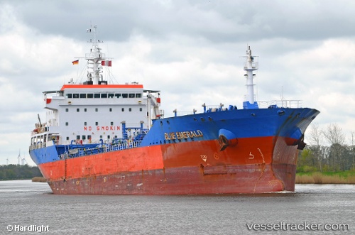
Vessel Blue Emerald IMO: 9475430, MMSI: 538005140 Chemical Oil Products Tanker
UTC, -0.64170, 8.82011, course: 189, speed: 0
UTC, -0.64174, 8.82038, course: 200, speed: 0
2026-02-06 17:45:32 UTC, -0.64179, 8.82046, course: 207, speed: 0
Live AIS position:
UTC. Near Port Gentil),
updated 2026-02-06 17:45:32 UTC.
Find the position of the vessel Blue Emerald on the map. The latter are known coordinates and path.
marine traffic ship tracker show on live map
The current position of vessel Blue Emerald is -0.64179 lat / 8.82046 lng. Updated: 2026-02-06 17:45:32 UTCDetails:
Last coordinates of the vessel:
UTC, -0.64172, 8.81943, course: 175, speed: 0UTC, -0.64170, 8.82011, course: 189, speed: 0
UTC, -0.64174, 8.82038, course: 200, speed: 0
2026-02-06 17:45:32 UTC, -0.64179, 8.82046, course: 207, speed: 0