 vesseltracker.com
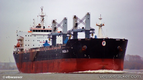
Vessel Magda P IMO: 9476692, MMSI: 241075000 Bulk Carrier
UTC, 3.91833, -12.87167, course: -1, speed: 9
UTC, 4.18465, -13.07771, course: 319, speed: 10.1
2026-02-10 03:56:19 UTC, 4.48325, -13.30664, course: 318, speed: 10.1
Live AIS position:
UTC. 186 nm SW of Monrovia),
updated 2026-02-10 03:56:19 UTC.
Find the position of the vessel Magda P on the map. The latter are known coordinates and path.
marine traffic ship tracker show on live map
The current position of vessel Magda P is 4.48325 lat / -13.30664 lng. Updated: 2026-02-10 03:56:19 UTCDetails:
Last coordinates of the vessel:
UTC, 3.69613, -12.70609, course: 319, speed: 10.3UTC, 3.91833, -12.87167, course: -1, speed: 9
UTC, 4.18465, -13.07771, course: 319, speed: 10.1
2026-02-10 03:56:19 UTC, 4.48325, -13.30664, course: 318, speed: 10.1